
Norway Fjords Map & Route Planner
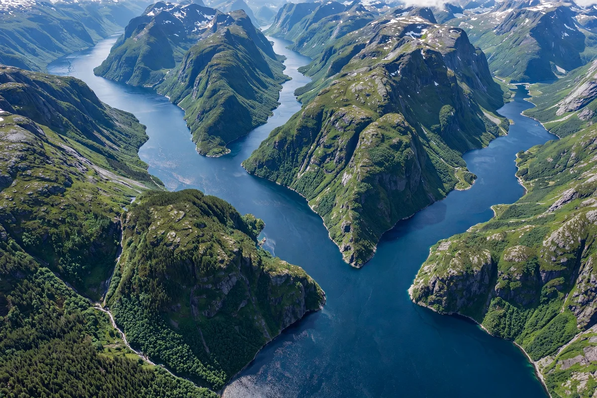
The fjords are not one place. They are a thousand kilometres of coast, from Stavanger in the south to Tromsø in the north, and the first mistake most travellers make is treating them as a single destination. The right way to plan a fjord trip is by region: pick a base, see the fjords around it, and move on when you have seen them. This guide is the map and the planner for that approach, with the four regions, the bases, the transport and the guides that cover each part.
The guides on this site cover each fjord and each city in full, and this planner tells you which ones to read, and in what order, for the trip you want.
The four fjord regions
The fjords fall into four regions, and each region has its own bases, its own transport, and its own character. The south is the Lysefjord and the Hardangerfjord, the fjords of Stavanger and Bergen. The centre is the Sognefjord and the Nærøyfjord, the longest and the narrowest fjords, and the base is Flåm. The north-centre is the Geirangerfjord and the Hjørundfjord, the fjords of Ålesund. The Arctic is the fjords of Tromsø and the Lofoten Islands, and the base is Tromsø.
| Region | Bases | Main fjords | Days needed | Best transport |
|---|---|---|---|---|
| South | Stavanger, Bergen | Lysefjord, Hardangerfjord | 2 to 3 | Day boat, car, bus |
| Centre | Flåm, Balestrand | Sognefjord, Nærøyfjord, Aurlandsfjord | 2 to 3 | Train, boat, car |
| North-centre | Ålesund, Geiranger | Geirangerfjord, Hjørundfjord, Nordfjord | 2 to 3 | Bus, car, boat |
| Arctic | Tromsø, Svolvær | Tromsø fjords, Lofoten, North Cape coast | 3 to 5 | Coastal voyage, car, bus |
Most travellers see two regions in a week, and three in ten days. One region in a week is slow, and it is the best way to see the fjords properly. Four regions in a week is a drive, not a trip.
Base one: Bergen, the gateway
Bergen is the gateway to the fjords, and it is the base most travellers start from. It has the airport, the railway station, the harbour and the express boats, and it is the start of the Nutshell route, the Flåm Railway and the coastal voyage. From Bergen, the fjords you can reach in a day are the Osterfjord, by the Mostraumen boat, the Hardangerfjord, by the express boat to Rosendal, and the Sognefjord, by the express boat to Flåm.
Bergen is also a city worth two days on its own. The Bryggen wharf, the Fløibanen funicular up Mount Fløyen, and the fish market are the centre, and the harbour is the start of the fjord boats. The Bergen guide covers the city in full, with the maps, the prices and the day trips. The Hardangerfjord guide covers the fjord to the south, and the Sognefjord guide covers the fjord to the north.
Stay in Bergen for two nights at the start of the trip, and use it as the base for the southern and central fjords. Fly into Bergen, or take the train from Oslo, about seven hours across the Hardangervidda plateau, and start the fjords from there.
Base two: Flåm and Aurland, the centre
Flåm is the base for the central fjords, and it is the smallest base on this list. It is a village at the head of the Aurlandsfjord, with the Flåm Railway, the Nærøyfjord boat and the Stegastein viewpoint, and it is the base for the Sognefjord and the Nærøyfjord. From Flåm, the fjords you can reach in a day are the Aurlandsfjord, by the boat, the Nærøyfjord, by the boat to Gudvangen, and the Sognefjord, by the ferry to Balestrand.
Flåm is small, and it is busy in summer, so book the hotel early. The Flåm Railway runs from Myrdal down to Flåm, 20 kilometres in about an hour, from NOK 399 for an adult, and it is the best way to reach the village. The Flåm Railway guide covers the railway in full, and the Aurlandsfjord guide and the Nærøyfjord guide cover the fjords. The Norway in a Nutshell guide covers the route that takes you to Flåm and back in a day.
Stay in Flåm for one or two nights, and use it as the base for the central fjords. The village has few hotels, and the best ones sell out in summer, so book early, or stay in Aurland, a short drive away, or in Balestrand, across the fjord.
Base three: Ålesund, the north-centre
Ålesund is the base for the north-central fjords, and it is the prettiest town on the coast. It is an Art Nouveau town on the water, with the Aksla viewpoint, 418 steps above the town, and it is the base for the Geirangerfjord, the Hjørundfjord and the Nordfjord. From Ålesund, the fjords you can reach in a day are the Geirangerfjord, by the direct bus, about two and a half hours, daily from 1 June to 30 September, and the Hjørundfjord, by the day boat, about five hours with an hour’s stop at Øye.
Ålesund is also the base for the Trollstigen road and the Atlantic Road, and it is the end of the seven-day road trip from Bergen. The Ålesund guide covers the town in full, and the Geirangerfjord guide and the Hjørundfjord guide cover the fjords. The road trip guide on this site covers the seven-day drive from Bergen to Ålesund in full, day by day, with the distances and the ferries.
Stay in Ålesund for two nights, and use it as the base for the northern fjords. Fly into Ålesund Airport Vigra, or take the bus from Bergen, or drive the fjord road from Geiranger, and start the northern fjords from there.
Base four: Stavanger, the south
Stavanger is the base for the southern fjords, and it is the base most travellers skip. It should not be skipped: the Lysefjord is one of the best fjords in Norway, and the Pulpit Rock, 604 metres above the fjord, is the most famous viewpoint in the country. From Stavanger, the fjords you can reach in a day are the Lysefjord, by the day boat, about three hours from NOK 890 for an adult, and the Hardangerfjord, by the bus and the boat to the south.
Stavanger is a city, with the old town, the oil museum and the harbour, and it is the easiest base to reach: the airport has flights from Oslo and from London, and the train runs from Oslo in about eight hours. The Stavanger guide covers the city in full, and the Lysefjord and Preikestolen guide covers the fjord and the hike.
Stay in Stavanger for two nights, and use it as the base for the southern fjords. It is the best base for the Pulpit Rock hike, because the bus leaves from the city, and it is the best base for the Lysefjord boat, because the boat leaves from the harbour.
Base five: Oslo and Tromsø, the start and the end
Oslo is the start of the fjord trip for most travellers who fly into Norway, and it is worth two days on its own. The Oslofjord is not a fjord in the western sense, but the city has the harbour, the museums and the trains to Bergen, and it is the start of the Bergen Line, about seven hours across the Hardangervidda plateau. The Oslo guide covers the city in full.
Tromsø is the base for the Arctic, and it is the end of the fjord trip for travellers who go north. It is the Arctic city, with the northern lights in winter and the midnight sun in summer, and it is the base for the fjords of the north, the Lofoten Islands and the North Cape. The Tromsø northern lights guide covers the city in full, and the 14-day Arctic Circle itinerary covers the Arctic route.
The tools: maps, planners and timetables
The best map for the fjords is Google Maps, and it is the one to use for the driving and the walking. It has the fjord roads, the ferry crossings and the viewpoints, and it works offline if you download the area first. The links in this guide and in the guides on this site open Google Maps from the place name, and they are the fastest way to find the places named in the guides.
The best planner for public transport is Entur, Norway’s national journey planner, at entur.no and in the Entur app. It covers the whole country: trains, buses, ferries, trams and the metro, in one search, and it sells the tickets at the operator’s price, with no surcharge. It is the planner to use for the Nutshell route, the buses to Geiranger, the express boats and the coastal voyage, because it shows the connections and the times in one place.
The regional apps cover the local routes: Skyss for Bergen and the Vestland region, Ruter for Oslo and Akershus, AtB for Trondheim and Trøndelag. Use Entur for the long journeys and the regional app for the local buses and boats, and use Vy, the train operator, for the train tickets.
The road conditions are on vegvesen.no, the Norwegian Public Roads Administration. Check it before every mountain day, because the Trollstigen and the Geiranger mountain road close in winter, and the ferries run less often in the shoulder season. The ferry times are on the operator’s site, and the operator’s site is the one to trust for the fares, because the ferries change their prices seasonally.
Three ready-made routes
The two-day route is Bergen and the Nutshell. Fly into Bergen, spend a day in the city, take the Nutshell route on the second day, and fly home. It shows you two fjords and the Flåm Railway, and it is the best fjord trip for a short break.
The seven-day route is Bergen to Ålesund by road. Bergen, Flåm, Balestrand, Geiranger and Ålesund, with the Stegastein viewpoint, the Trollstigen road and the fjord boats, in seven days. The road trip guide on this site covers it in full, day by day, with the distances and the ferries.
The twelve-day route is Bergen to Kirkenes and back on the coastal voyage. The whole coast, 34 ports, the fjord detours and the Arctic, in twelve days, with no driving and no flying. The coastal express guide on this site compares the northbound, southbound and round trip options in full. The 7-day, 10-day and 14-day comparison covers the cruise lengths, and the Complete Guide covers the whole fjord trip.
If you would rather not drive at all, the public transport options are covered in full in the guide on this site on visiting the fjords without a cruise.
The fjords, mapped by guide
The guides on this site cover the fjords in order, from south to north, and this is the map of them. The Lysefjord and the Hardangerfjord are the south, covered by the Stavanger guide, the Lysefjord guide and the Hardangerfjord guide. The Sognefjord, the Aurlandsfjord, the Nærøyfjord and the Lustrafjord are the centre, covered by the Sognefjord guide, the Aurlandsfjord guide, the Nærøyfjord guide and the Lustrafjord guide. The Geirangerfjord, the Hjørundfjord and the Nordfjord are the north-centre, covered by the Geirangerfjord guide, the Hjørundfjord guide and the Sognefjord vs Geirangerfjord comparison. The Arctic is covered by the Tromsø guide and the 14-day Arctic itinerary. The best time guide covers the seasons month by month, and the cost and budget guide covers the prices. The first-timer tips guide covers the booking mistakes to avoid, and the packing list guide covers what to wear by season.
What to skip
Skip the idea of seeing all the fjords in a week. The coast is a thousand kilometres long, and the fjords are slow, and the trip that tries to see them all sees none of them properly. Skip the map that shows the fjords as a single line: the fjords are a region, not a route, and the right map is the region you are in. Skip the planner that only shows the driving time: the fjords are the ferries, the viewpoints and the stops, and the driving time is the smallest part of the day. And skip the guide that tells you to book the hotels last: the fjord villages have few rooms, and the best ones sell out in summer, so book the hotels first, and the transport second.
Finding your way around
Key map links for the fjord regions:
- Bergen, Norway, the gateway city and the start of the fjords
- Stavanger, Norway, the base for the Lysefjord
- Flåm, Norway, the base for the central fjords
- Balestrand, Norway, the Sognefjord village
- Geiranger, Norway, the village at the head of the Geirangerfjord
- Ålesund, Norway, the base for the northern fjords
- Oslo, Norway, the start of the Bergen Line
- Tromsø, Norway, the base for the Arctic
- Svolvær, Norway, the Lofoten capital
Frequently asked questions
How do I plan a Norway fjords route?
Plan by region, not by fjord list. Pick a base, see the fjords around it, and move on. The four regions are the south (Stavanger, Bergen), the centre (Flåm, Balestrand), the north-centre (Ålesund, Geiranger) and the Arctic (Tromsø, Svolvær). Most travellers see two regions in a week.
What is the best base for the Norwegian fjords?
Bergen is the best base for the first trip, because it has the airport, the railway, the harbour and the express boats, and it is the start of the Nutshell route. Flåm is the best base for the central fjords, Ålesund is the best base for the northern fjords, and Stavanger is the best base for the Lysefjord.
What is Entur, and do I need it?
Entur is Norway’s national journey planner, at entur.no and in the Entur app. It covers trains, buses, ferries, trams and the metro in one search, and it sells the tickets at the operator’s price, with no surcharge. Use it for the buses, the express boats and the connections between the fjord towns.
How many days do I need for the Norwegian fjords?
Two days for one fjord and one base, seven days for two regions, twelve days for the whole coast. The seven-day route, Bergen to Ålesund by road, is the best week. The twelve-day coastal voyage, Bergen to Kirkenes and back, is the best twelve days.
Can I see the fjords on a map before I go?
Yes. Google Maps has the fjord roads, the ferry crossings and the viewpoints, and it works offline if you download the area first. The guides on this site link to Google Maps from the place names, and the links in this guide open the map for each base and each fjord.



One Comment