Norwegian Fjords Facts: How They Formed, How Deep, How Many
A fjord is a valley the sea moved into. Glaciers carved it, the ice melted, and the sea rose to fill it, leaving a long arm of salt water between steep walls of rock. Norway has more of them than any other country, and the questions people ask about them are almost always the same: how did they form, how many are there, which is the longest, which is the deepest, and what does the word fjord actually mean. This guide answers those questions with the figures as they stand, and says where the sources disagree.
How fjords formed
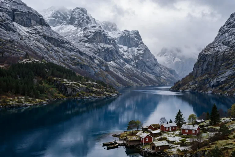
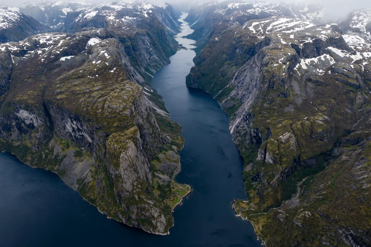
Fjords were carved by glaciers, not by rivers. Over the last 2.6 million years, in the Quaternary period, Norway went through some 40 to 50 ice ages, and each one sent glaciers down the valleys to the sea. The ice was heavy enough to grind the valley floors down below sea level, a process called overdeepening, and it widened the river valleys from a V shape into the steep-sided U shape that marks a fjord. The valleys were already there, cut by rivers over millions of years; the glaciers deepened and straightened them.
When the last ice age ended, about 11,000 years ago, the ice melted and the sea rose, flooding the deep valleys. The result is a fjord: a long, narrow inlet of the sea, with steep sides that continue far below the waterline. The rock walls of the Nærøyfjord, for example, extend about 500 m below sea level, which is why the cliffs look so much taller than the water is deep. The exact date the ice left varies by place and by source: NASA gives about 10,000 years ago, Science Norway gives about 11,000, and the Holocene, the geological period that followed the ice, is dated to 11,700 years ago. The safe statement is that the fjords took their present shape as the last ice melted, roughly 10,000 to 12,000 years ago.
The carving did not happen in one ice age. Each glaciation deepened the valleys a little more, and the fjords are the sum of many ice ages, not the work of one. That is why the deepest fjords are also the longest: the biggest glaciers, flowing down the longest valleys, cut the deepest channels.
How many fjords are there in Norway?
More than 1,000. That is the figure Visit Norway uses, and it is the safe answer: “more than a thousand fjords” covers every named fjord on the coast without pretending to a precision no one can give. The most precise count found is about 1,190 fjords in Norway and the Svalbard islands, from the Wikipedia list of Norwegian fjords. One travel site claims 1,700, with no sourcing, and that figure should not be used: it depends on counting unnamed inlets, and it is not the figure the official sources give.
The number is hard to pin down because there is no single line between a fjord and a bay, an inlet or a sound. A fjord is a long, narrow inlet with steep sides, carved by a glacier, but the coast is full of inlets that are fjord-like without being named fjords, and of fjord arms that may or may not be counted separately. The Sognefjord alone has arms that are famous in their own right, the Nærøyfjord, the Aurlandsfjord and the Lustrafjord among them, and whether you count those as three fjords or one depends on the list you are reading. “More than 1,000” is the honest answer, and the only one that survives every way of counting.
The longest fjord in Norway
The Sognefjord, at about 205 km long. It runs from the open sea near the coast all the way inland to Skjolden, and it is the longest fjord in Norway and in Europe. Some sources give 204 km; 205 km is the most common figure, and the difference is a rounding of where the fjord is measured from. The Hardangerfjord is Norway’s second longest, at about 180 km, with sources giving 179, 180 and 183 km.
The Sognefjord is also the second longest fjord in the world. The longest is Scoresby Sund, also called Scoresby Sound, in Greenland, at about 350 km. Its main body is only about 110 km long, and the 350 km figure is the longest branch of its system, so the comparison is not exact, but no other fjord comes close to it in length. The Sognefjord’s second place is not close either: at about 205 km, it is far longer than any fjord outside Greenland.
Length is measured along the fjord’s centre line, from the mouth to the head, and the figure changes with the route taken and with whether the arms are included. The Sognefjord’s 205 km is the main fjord alone; counting its arms would make the system longer still.
The deepest fjord in Norway
The Sognefjord again, at 1,308 m deep at its deepest, near the village of Høyanger. It is the deepest fjord in Norway and in Europe, and one of the deepest in the world. Some sources give 1,303 m, a rounding difference; 1,308 m is the figure most sources use, including a 2020 marine science paper on the fjord.
It is not safe to call the Sognefjord the deepest fjord in the world. Some travel sources do, but depths of up to 1,450 m have been reported in parts of the Scoresby Sund system in Greenland, so the world title is not supported. “Deepest in Norway and Europe” is the safe statement, and it is true on every source.
The depth is not uniform. The fjord is shallow at its mouth, where a sill of rock about 170 m deep separates it from the open sea, and deep in its inner basins, where the glacier cut hardest. The sill matters: it is the ridge the glacier left behind, and it limits how freely the fjord’s deep water mixes with the sea outside. The other fjords follow the same pattern on a smaller scale: the Geirangerfjord is about 260 m deep, the Hardangerfjord about 850 m, the Aurlandsfjord about 962 m, and the Lysefjord over 400 m. The Nærøyfjord’s water depth is not published as a single figure, and the often-quoted 500 m is the rock walls’ extent below sea level, not the water depth.
The narrowest fjord in Norway
The Nærøyfjord, at 250 m wide at its narrowest point, near the village of Bakka. It is Norway’s narrowest fjord, and it is often described as the narrowest fjord in the world. Visit Norway states that flatly; other guides hedge with “one of the narrowest in the world” or “Norway’s, and perhaps the world’s, narrowest fjord”. UNESCO does not call it the narrowest: its listing describes the Geirangerfjord and Nærøyfjord areas as among the most scenically outstanding fjord areas on the planet, which is a statement about scenery, not width. The narrowest claim should be attributed to general usage, not to UNESCO.
The Nærøyfjord’s width varies along its length: UNESCO gives the range as 250 m to 2.5 km. Its length is also given differently in different sources, 17, 18 and 19 km, and this guide uses “about 18 km”, matching the site’s Nærøyfjord guide. The narrowness is the point of the fjord: the walls are so close that a boat feels small in the water, and the waterfalls fall almost onto the deck. Large cruise ships cannot enter it, and the shallow sill at its mouth, about 12 m deep at its shallowest near Bakka, keeps big ships out.
What does the word fjord mean?
The word fjord comes from the Old Norse fjörðr, meaning a lake-like body of water used for passage and ferrying. It comes from the Proto-Germanic word for a crossing, and from an older Indo-European root meaning to lead or pass over. The sense of the word, as the dictionary puts it, is probably “a going, a passage”. It is related to the English words ferry, fare and ford, to the Scots firth, and to the German Förde.
The meaning fits the thing. A fjord was a passage before it was a view: the waterway that connected the farms and villages along its shores, and the route boats took between the sea and the inland valleys. The name Nærøyfjord means the narrow fjord, from the Old Norse word for narrow, and it describes exactly what you see from the boat. The names of the fjords are old, and most of them describe the water itself: Sognefjord is the fjord of the Sogn district, Hardangerfjord the fjord of Hardanger, Lysefjord the light fjord, from the pale rock of its walls.
In New Zealand the same word is spelled “fiord”, as in Milford Sound and Doubtful Sound, which are fjords by every measure except their name. The spelling is the only difference.
What is in fjord water?
Fjord water is layered. Rivers and meltwater run into the fjord from the land, and because fresh water is lighter than salt water, it spreads as a thin brackish layer on the surface and flows out to sea. Below it sits the salt water that came in from the ocean, denser and heavier, and the two layers mix only slowly. The surface layer is why fjord water often looks green or milky near the shore, especially in early summer when the snow is melting and the rivers carry fine rock flour from the glaciers.
The sill at the fjord’s mouth shapes everything below the surface. It is a ridge of rock or moraine left by the glacier, and it is much shallower than the fjord behind it: the Sognefjord’s sill is about 170 m deep, while the basin behind it is 1,308 m deep. The sill restricts the exchange of water with the open sea. Deep water is renewed only when dense coastal water spills over the sill, which happens rarely, so the water in the deep basins can sit still for a long time and lose oxygen. That is why fjord bottoms are quiet places, and why the life of a fjord is concentrated near the surface and along the shores.
The layering also explains the fjord’s colour. The deep water is dark blue, the surface layer is green where it carries meltwater, and the water is clearest in winter, when the rivers run low and the meltwater stops.
Why fjords have so many waterfalls
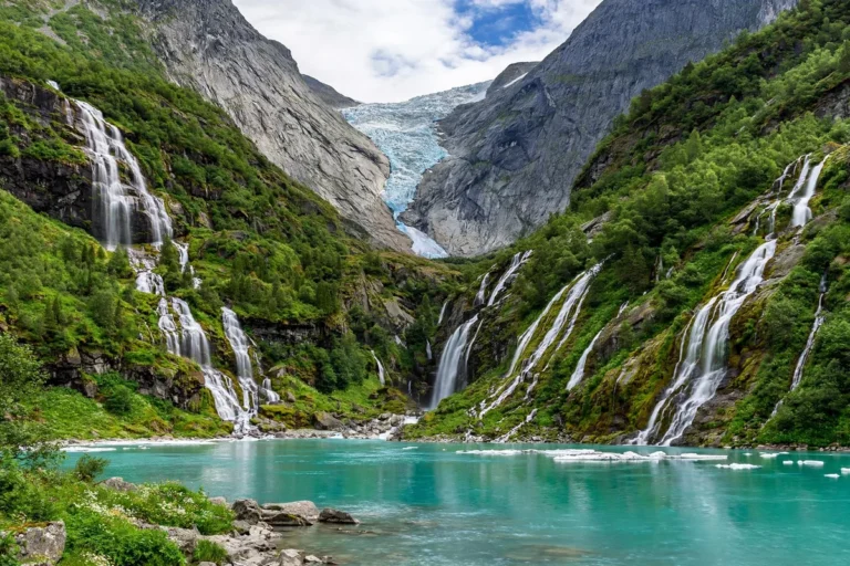
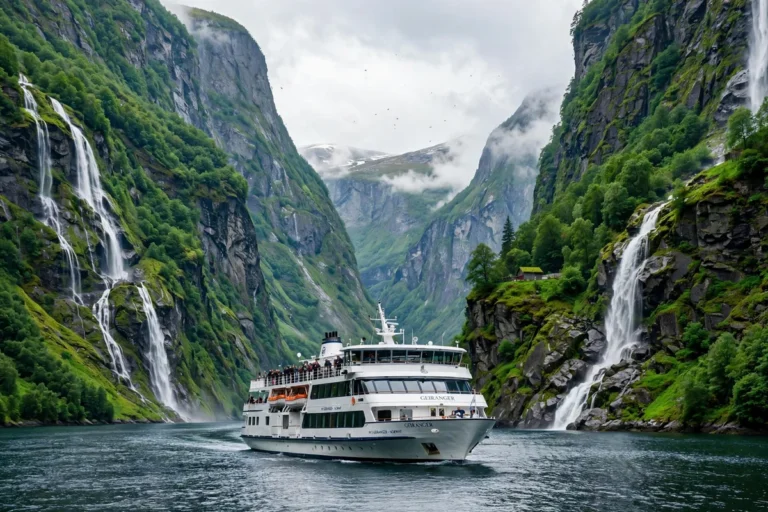
The waterfalls are a direct result of how the fjords were carved. The main glacier, flowing down the main valley, cut far deeper than the smaller glaciers in the side valleys. When the ice melted, the side valleys were left hanging high above the fjord floor, and the streams running out of them had nowhere to go but straight down the cliff. That is why the waterfalls of the fjords fall in long single drops instead of running down a slope: the Seven Sisters on Geirangerfjord, the Suitor opposite them, and the falls along the Nærøyfjord all drop from hanging valleys into the water below.
The falls are strongest in May and June, when the snow is melting, and they thin out by late summer. Some of them dry up almost entirely in a dry August. The farms on the ledges above the fjords, such as Skageflå on Geirangerfjord, sit on the flat floors of those hanging valleys, which is why they are reachable only by boat or on foot: the valley that holds the farm ends in a cliff above the water.
Where else in the world are there fjords?
Fjords are not only Norwegian. They occur wherever glaciers once reached the sea: in New Zealand, where they are spelled fiord and include Milford Sound and Doubtful Sound; in Chile, along the long southern coast; in Alaska, in the United States; in Greenland, where Scoresby Sund is the longest fjord in the world; in Iceland, which has 109 fjords; in Scotland, where they are often called firths or lochs; and in Canada, notably in British Columbia and Nunavut. They are also found in Tasmania and in Ireland, on a smaller scale.
Norway has the most. With more than 1,000 fjords, against Iceland’s 109, Norway tops the list of fjord countries by a wide margin, and it is Norway and Canada that are most known for fjords. The reason is the ice: Norway’s coast faced the full weight of the Scandinavian ice sheet, and its valleys ran straight to the sea, so the glaciers had a direct route to carve. The fjords of New Zealand and Chile are as steep and as beautiful, but there are fewer of them, and they are further from the places most travellers start from.
Which fjords are UNESCO listed?
Two: Geirangerfjord and Nærøyfjord. They were inscribed on the UNESCO World Heritage List on 14 July 2005, under the name “West Norwegian Fjords – Geirangerfjord and Nærøyfjord”, on natural criteria for outstanding beauty and outstanding geology. In the current UNESCO numbering those are criteria (vii) and (viii); the 2005 decision cited them as (i) and (iii) under the numbering then in use.
The listing covers those two fjord areas, not every fjord in Norway. The Sognefjord, the Hardangerfjord and the Lysefjord are not UNESCO listed, and the listing does not cover the whole Sognefjord system, only the Nærøyfjord arm of it. The two listed fjords were chosen because they are, in UNESCO’s words, among the most scenically outstanding fjord areas on the planet, and because they preserve a clear record of how glaciers formed the landscape. That record is also the reason the two fjords are listed together: they show the same story from two sides, one wider and full of waterfalls, the other narrower and steeper.
Fjord records at a glance
| Record | Fjord | Figure |
|---|---|---|
| Longest in Norway | Sognefjord | About 205 km |
| Longest in the world | Scoresby Sund, Greenland | About 350 km |
| Second longest in Norway | Hardangerfjord | About 180 km |
| Deepest in Norway and Europe | Sognefjord | 1,308 m |
| Narrowest in Norway | Nærøyfjord | 250 m at its narrowest |
| Most fjords in one country | Norway | More than 1,000 |
| Oldest carving | Quaternary glaciations | About 2.6 million years |
| UNESCO listed fjords | Geirangerfjord and Nærøyfjord | Inscribed 2005 |
How to see the facts for yourself
These Norwegian fjords facts are best checked on the water. The Sognefjord’s length is felt on the boat from Flåm to Gudvangen, the Nærøyfjord’s narrowness is felt when the walls close in near Bakka, and the Geirangerfjord’s depth is felt when the sightseeing boat passes the Seven Sisters and the cliffs rise on both sides. Our Geirangerfjord guide and our Nærøyfjord guide cover the two UNESCO fjords in detail, and our Sognefjord guide covers the longest and deepest. For when to go, see our best time to visit guide.
How were the fjords formed?
Glaciers carved them. Over about 2.6 million years, some 40 to 50 ice ages sent glaciers down Norway’s river valleys to the sea, grinding the valley floors below sea level and widening them from a V shape into a steep-sided U shape. When the last ice age ended, about 11,000 years ago, the ice melted and the sea rose, flooding the deep valleys. The result is a fjord: a long, narrow inlet of the sea between steep rock walls.
How many fjords are there in Norway?
More than 1,000. That is the figure Visit Norway uses, and the most precise count found is about 1,190 fjords in Norway and the Svalbard islands. The number is hard to pin down because there is no single line between a fjord and a bay or an inlet, and because fjord arms may or may not be counted separately. One travel site claims 1,700, with no sourcing, and that figure should not be used.
What is the longest fjord in Norway?
The Sognefjord, at about 205 km long. It is the longest fjord in Norway and in Europe, and the second longest in the world after Scoresby Sund in Greenland, at about 350 km. The Hardangerfjord is Norway’s second longest, at about 180 km.
What is the deepest fjord in Norway?
The Sognefjord, at 1,308 m deep at its deepest, near Høyanger. It is the deepest fjord in Norway and in Europe. It is not safe to call it the deepest in the world: depths of up to 1,450 m have been reported in parts of the Scoresby Sund system in Greenland. The fjord is shallow at its mouth, where a sill of rock about 170 m deep separates it from the open sea.
What does the word fjord mean?
It comes from the Old Norse fjörðr, meaning a lake-like body of water used for passage and ferrying, from a root meaning to lead or pass over. The sense of the word is probably “a going, a passage”. It is related to the English words ferry, fare and ford, to the Scots firth and to the German Förde. In New Zealand the same word is spelled “fiord”.
Are there fjords outside Norway?
Yes. Fjords also occur in New Zealand, where they are spelled fiord and include Milford Sound and Doubtful Sound, in Chile, Alaska, Greenland, Iceland, which has 109 fjords, Scotland, where they are often called firths or lochs, and Canada, notably British Columbia and Nunavut. Norway has the most, with more than 1,000 fjords, and it is Norway and Canada that are most known for fjords.