
Lysefjord & Preikestolen Guide: Hike the Cliff, Cruise the Fjord
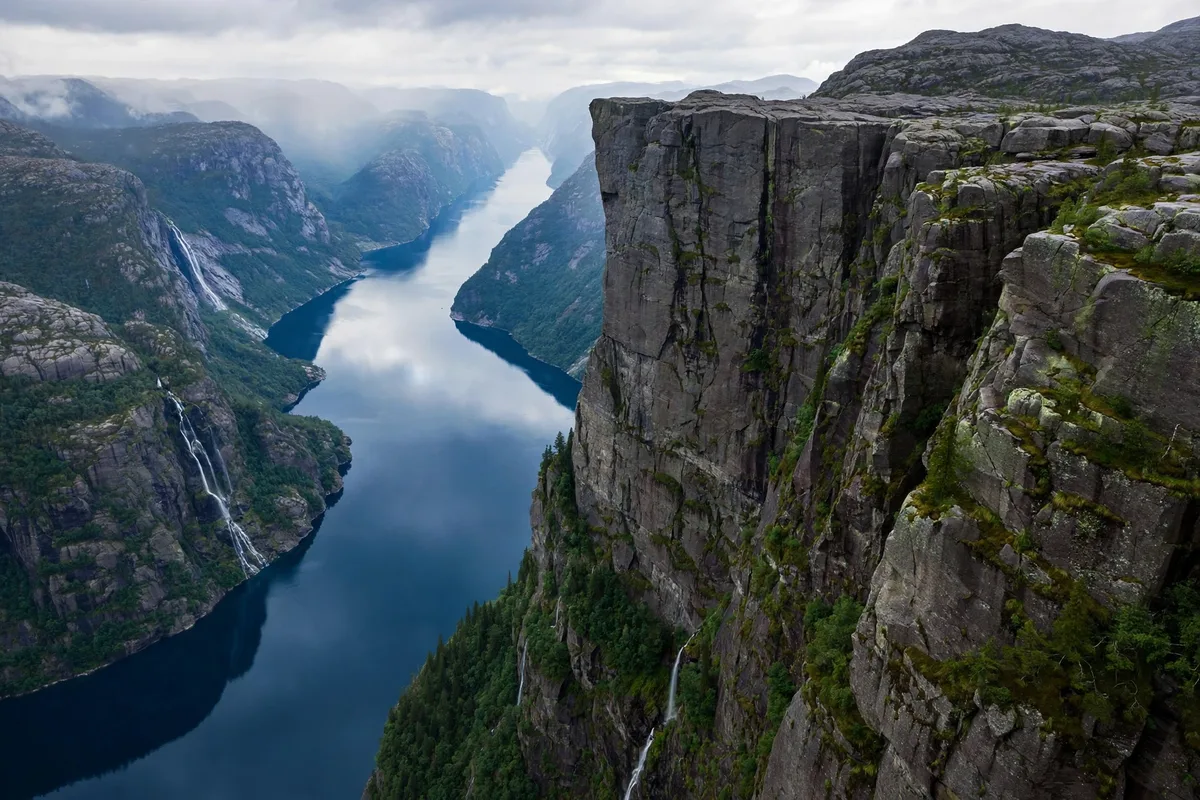
Lysefjord and Preikestolen are the same sight from two directions, and you should see both. The fjord is 42 km long, with cliffs up to 1,000 metres high, and Preikestolen, Pulpit Rock, is the flat-topped cliff 604 metres above the water that has become one of Norway’s most photographed places. The cruise sails beneath the cliff in three to three and a half hours. The hike climbs to the top of it in four to five hours. Each one is worth a day, and each one shows you something the other cannot.
The base is Stavanger, on the south-west coast, and the fjord starts almost at the city’s doorstep. The cruise boats leave from the harbour, and the hike starts with a bus ride through a tunnel under the fjord. It is the most efficient fjord trip in Norway for a short stay: two days in Stavanger covers the city, the cruise and the hike, and it is the warmest and driest of the fjord regions.
The fjord and the cliff
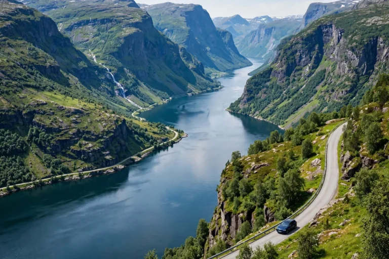
The Lysefjord cuts 42 km inland from Stavanger, between cliffs that rise up to 1,000 metres from the water. It is a different kind of fjord from the big western ones: shorter, steeper, and closer to a city. The light is different too, because the fjord runs east to west, and the cliffs throw long shadows across the water in the morning and evening.
Preikestolen is the reason most visitors come. The cliff is a flat plateau of rock 604 metres above the fjord, with no railings at the edge, formed by glaciers. The name means the Pulpit Rock, or the Preacher’s Pulpit, and it fits: the plateau looks like a pulpit above the fjord.
The fjord and the cliff belong together. From the boat, the cliff is a small flat edge 604 metres above you, and the scale of the fjord becomes clear. From the top, the fjord is a green ribbon below, and the scale of the height becomes clear. Do both if you can.
The Lysefjord cruise
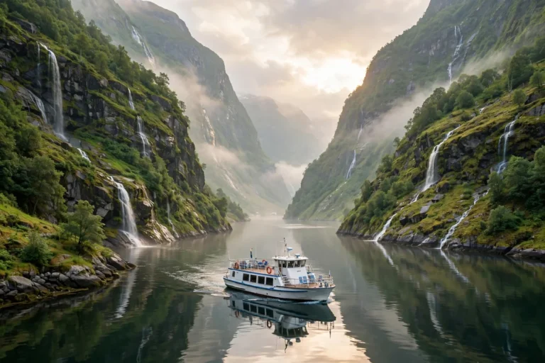
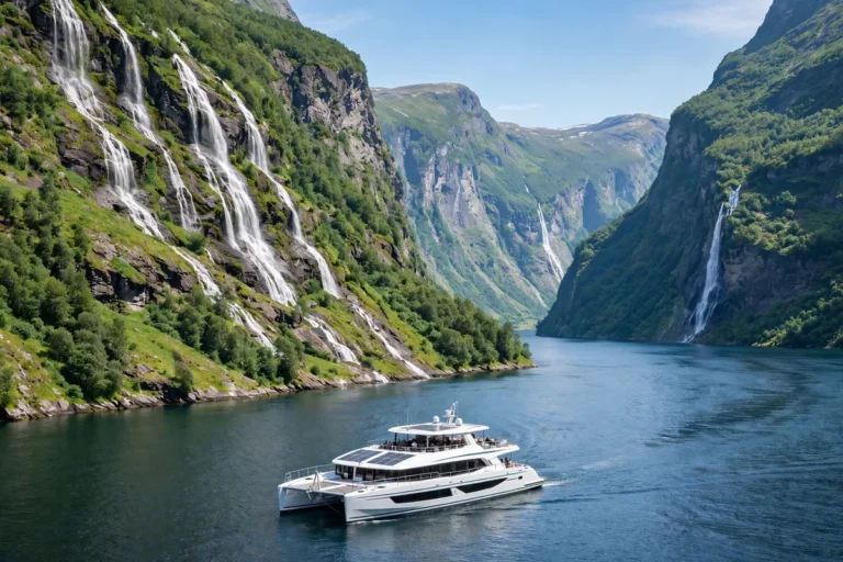
The Lysefjord cruise is the easiest fjord trip in Norway. Rødne’s electric catamaran leaves from Strandkaien in Stavanger harbour and sails up the 42 km fjord to below Preikestolen and back in three to three and a half hours, passing the Hengjanefossen waterfall and the Vagabond’s Cave. The cliff rises 604 metres directly above the boat.
An adult ticket costs around NOK 890 and a child ticket around NOK 445, and the cruise runs all year. In winter it sails Thursday to Sunday at 11:00, and daily from April. It does not land anywhere, so it is for seeing the cliff from below, not for standing on it. The boat is electric and quiet, with a panoramic cabin and a sun deck, and there is a snack bar on board.
You can book the Lysefjord RIB Safari from Stavanger on Viator.
Book ahead in summer. The cruise is popular with Stavanger’s cruise passengers, and the morning sailing can sell out. The afternoon sailing is usually quieter, and the light on the cliffs is better.
The Preikestolen hike
The hike is the other half of the trip: an 8 km round trip, four to five hours, climbing about 350 metres to the plateau 604 metres above the Lysefjord. The trail is free, open and unstaffed, and it starts at the Preikestolen Mountain Lodge, about three kilometres past Jørpeland. The path is well marked and well built, with stone steps on the steep sections, and it is busy in summer, so start early if you want the plateau to yourself.
You can book the Guided hike to Pulpit Rock Preikestolen on Viator.
Getting there takes about 45 to 60 minutes by car through the Ryfylke Tunnel, or about an hour each way on the seasonal express bus from the bus terminal in Stavanger. The bus runs daily from about 1 May to 4 October, with a return ticket around NOK 550, and tickets are sold online in advance. Outside the bus season, and from November to April, you need winter equipment and a guide; the trail is not a winter walk without them.
The car park at the trailhead costs around NOK 275, and it fills up in summer, so arrive early or take the bus. Note that the old Stavanger to Tau car ferry closed when the Ryfylke Tunnel opened on 30 December 2019, so older guidebooks that send you to the ferry are out of date.
At the top, there are no railings. The plateau is flat and wide, but the edge is a sheer drop, and the wind can be strong. Stay back from the edge, keep children close, and do not go to the edge for a photograph. The view is the same from a few metres back.
Doing both: the two-day plan
The best way to see the fjord and the cliff is to give each one a day. Day one: the Lysefjord cruise from Strandkaien in the morning, and Stavanger’s old town and harbour in the afternoon. Day two: the Preikestolen hike, starting early, with the afternoon free for the Petroleum Museum or the harbour.
Do not try to do the cruise and the hike on the same day. The cruise takes three and a half hours and the hike takes four to five hours plus an hour each way, and each one deserves its own day. If you only have one day, choose the hike if you are fit and the weather is good, and the cruise if you are not, or if the weather is poor. The cruise runs in rain; the hike is miserable in it.
If you have three days, add Kjerag, the mountain at the end of the fjord, or the Lauvvik to Lysebotn car ferry, which runs the length of the fjord in about two and a half hours in summer. A sample two days looks like this: day one, the morning cruise from Strandkaien, lunch in the harbour, and the afternoon in Gamle Stavanger and the Petroleum Museum; day two, the early bus to the trailhead, the hike up and down, and the evening back in Stavanger with the fjord behind you.
Light and photography
The Lysefjord runs east to west, and the light changes the fjord through the day. In the morning the sun is behind the cliffs at the inner end, and the water is in shadow. In the afternoon the sun comes down the fjord from the west, and the cliffs on the northern side catch the light. The afternoon cruise is the better one for photographs, and the late light on the water is the best time to be on deck.
On the hike, the early morning is the time for the plateau: the trail is quieter, the light is softer, and the fjord below is still in shadow, which makes the height feel greater. By mid-morning in July the plateau is busy, and the light is flat. If you want the classic photograph of the plateau with the fjord below, go early, and stand back from the edge.
Kjerag and the boulder
Kjerag, the mountain at the end of the Lysefjord, is the harder hike. The Kjeragbolten boulder, wedged between two cliffs a thousand metres above the fjord, is the goal, and the trail is steeper and longer than Preikestolen. It is a summer-only trip, best reached by car or an organised tour, and it is for experienced hikers. The boulder photograph, standing on a rock wedged between two cliffs with a kilometre of air below, is famous, but the hike to reach it is serious, and the weather at the end of the fjord changes fast.
If Kjerag is too much, the Lauvvik to Lysebotn car ferry is the gentler way to see the inner fjord. It runs the length of the fjord in about two and a half hours in summer, from around NOK 595, and Lysebotn, the village at the end of the fjord, is the starting point for the road up to the mountains and the trail to Kjerag.
Flørli and the 4,444 steps
Flørli, on the southern shore of the Lysefjord, is a former power station village reached only by boat, and it is home to the longest wooden staircase in the world: 4,444 steps climbing the mountainside above the fjord. The steps follow the old water pipeline, and the climb is a full day’s hike, steep and exposed. It is a trip for fit hikers, and it is best combined with the ferry to Lysebotn. Flørli has a café and a few cabins in summer, and it is one of the quietest places on the fjord.
Getting there and getting around
Stavanger is the base, and the Stavanger guide covers the city in full: the airport 20 to 30 minutes away, the harbour, the old town and where to stay. The Lysefjord cruise leaves from Strandkaien in the harbour, a few minutes’ walk from the old town. The Preikestolen bus leaves from the bus terminal next to the station, and tickets are sold online in advance.
By car, the trailhead is reached through the Ryfylke Tunnel, about 45 to 60 minutes from Stavanger, and the car park costs around NOK 275. The Lauvvik ferry terminal is about 30 minutes from Stavanger by car, and the ferry runs to Lysebotn in summer.
The cost and budget guide covers transport prices across the fjords.
Where to stay
Stay in Stavanger if you are doing the cruise and the hike: the hotels around the harbour put you within minutes of the boat and the bus, and the city has restaurants and cafés that stay open all year. The Preikestolen Mountain Lodge, at the trailhead, is the alternative if you want to start the hike at dawn, and it has rooms and a restaurant. Lysebotn has a few cabins and a café in summer, and it is the base for Kjerag. Flørli has cabins in summer too, for travellers who want a night on the fjord with no road at all. Book ahead in summer: Stavanger’s hotels fill up on cruise-ship days, and the Mountain Lodge is small.
What to skip
Skip the Preikestolen hike in winter without a guide; the trail is not a winter walk, and the bus does not run. Skip driving to the trailhead without checking the parking situation in summer; the car park fills up, and the fee is around NOK 275. Skip trying to do the cruise and the hike on the same day; each one deserves its own day. And skip the old Stavanger to Tau ferry route in any guidebook that still lists it; the ferry closed in 2019 and the tunnel replaced it.
Best time to visit
May to September is the main season: the Preikestolen bus runs daily, the Lysefjord cruise sails daily, the days are long and the hiking trails are open. June and July are the busiest, and the Preikestolen trail can feel crowded by mid-morning. Go early if you want the plateau to yourself. October to April is the low season: the fjord cruise still runs, but on a reduced winter timetable, the Preikestolen bus stops, and the trail needs winter equipment and a guide. Stavanger is the mildest of the fjord cities, with less rain than Bergen, so the shoulder seasons are more forgiving here. The best time to visit the Norway fjords guide covers the seasons in full.
Finding your way around
Key map links for the fjord and the cliff:
- Preikestolen, the cliff itself, 604 metres above the Lysefjord
- Strandkaien, Stavanger, the Lysefjord cruise boats leave from here
- Preikestolen Mountain Lodge, the trailhead, past Jørpeland
- Kjeragbolten, the boulder at the end of the fjord
- Flørli, Norway, the power station village with the 4,444 steps
- Lysebotn, Norway, the village at the end of the fjord
- Lauvvik, Norway, the car ferry terminal for Lysebotn
Lysefjord and Preikestolen, compared
| Experience | How you get there | Time needed | Best for |
|---|---|---|---|
| Lysefjord cruise | Boat from Strandkaien | 3–3.5 hours | Seeing the cliff from below, no climbing |
| Preikestolen hike | Express bus + 8 km hike | Full day (7–8 hours) | Standing on the cliff itself |
| Both, over two days | Cruise day one, hike day two | 2 days | The full experience |
| Kjerag hike | Car or summer tour | Full day | The boulder, for experienced hikers |
| Lauvvik–Lysebotn ferry | Car ferry the length of the fjord | About 2.5 hours one way | A slow, scenic fjord crossing |
| Flørli steps | Boat to Flørli, climb 4,444 steps | Full day | The longest staircase in the world |
Frequently asked questions
Can I see Preikestolen without hiking?
Yes. The Lysefjord cruise from Strandkaien passes directly below the cliff, 604 metres above the boat, in three to three and a half hours. It runs all year, on a reduced winter timetable. It does not land anywhere, so it is for seeing the cliff from below, not for standing on it.
How long does the Preikestolen hike take?
Four to five hours for the 8 km return trip, climbing about 350 metres. Allow a full day including the bus or drive each way. Start early in summer, when the trail is busy by mid-morning.
How do I get to Preikestolen from Stavanger?
Take the seasonal express bus from the bus terminal, about an hour each way, with a return ticket around NOK 550, or drive through the Ryfylke Tunnel in 45 to 60 minutes. The bus runs daily from about 1 May to 4 October, and tickets are sold online in advance.
Is Preikestolen safe?
The trail is well built and well marked, and the plateau is flat and wide, but there are no railings at the edge. Stay back from the edge, keep children close, and do not go to the edge for a photograph. Do not hike in winter without a guide and winter equipment.
How many days should I allow for Lysefjord and Preikestolen?
Two days is the sweet spot: a day for the cruise and a day for the hike. Three days lets you add Kjerag, the Lauvvik to Lysebotn ferry, or the Flørli steps. Do not try to do the cruise and the hike on the same day.

2 Comments